
PREBLE COUNTY — At press time, Monday, Jan. 15, a winter weather advisory remained in effect through the afternoon and a wind chill advisory remained in effect from 11 p.m. until 3 p.m. Tuesday, Jan. 15 — kicking off another week of weather extremes for the area.
After a week which had the area with high temperatures near 60 and rain before plummeting for a weather system which had forecasters playing a guessing game as to where, what type and how much precipitation the Miami Valley would get on Friday, Feb. 12, Martin Luther King Jr. Day on Monday welcomed back the snow.
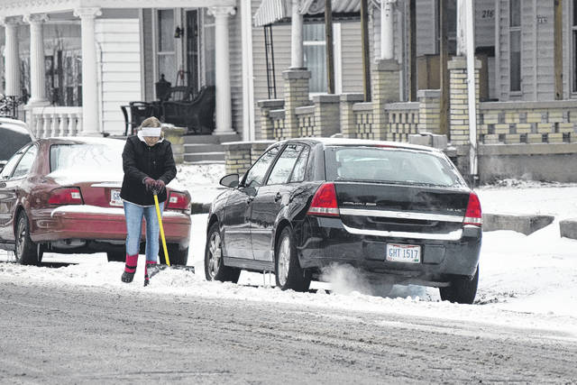
The blizzard that wasn’t on Feb. 12-13 brought a layer of ice to most and approximately an inch of snow, according to NWS data released for Eaton and West Alexandria. Wind gusts on Friday were expected to be up 30 miles per hour.
Snow and very cold wind chills were expected Monday into Tuesday, according to the National Weather Service in Wilmington, with accumulations of 2-4 inches expected and wind chills reaching up to 15-below-zero Monday night.
Drivers were urged to be prepared for reduced visibility at times, and residents were reminded the cold wind chills will cause frostbite in as little as 30 minutes to exposed skin.
The week’s forecast as of Monday called for more extremes, starting with the wind chill advisory on Monday into Tuesday and ending with highs near 50 on Saturday and Sunday, Jan. 20-21.
NWS in Wilmington forecast for the week:
Tuesday: Isolated snow showers. Mostly cloudy and cold, with a high near 9. Wind chill values as low as -16. West wind 9 to 13 mph. Chance of precipitation is 20 percent. Tuesday night —Isolated snow showers before 10 p.m., then a chance of flurries between 10 p.m. and 4 a.m. Mostly cloudy, with a low around 5. Wind chill values as low as -4. West wind 5 to 8 mph. Chance of precipitation is 20 percent.
Wednesday: Partly sunny, with a high near 20. West wind 5 to 8 mph. Wednesday night —Partly cloudy, with a low around 9.
Thursday: Sunny, with a high near 25. Thursday night — Mostly clear, with a low around 18.
Friday: Mostly sunny, with a high near 36. Friday night —Mostly cloudy, with a low around 29.
Saturday: Mostly cloudy, with a high near 47. Saturday night — A chance of showers. Cloudy, with a low around 41. Chance of precipitation is 30 percent.
Sunday: A chance of showers. Cloudy, with a high near 50. Chance of precipitation is 40 percent.
Precautionary/preparedness actions
According to the NWS, a Winter Weather Advisory for snow means periods of snow will cause primarily travel difficulties. Be prepared for snow covered roads and limited visibility, and use caution while driving. A Wind Chill Advisory means that cold air and the wind will combine to create low wind chills. Frostbite and hypothermia can occur if precautions are not taken. Everyone is reminded to wear a hat and gloves if venturing outside.
Additional information can be found at www.weather.gov.

