
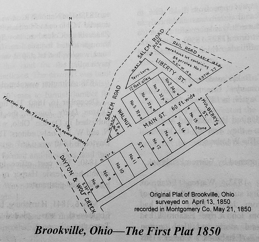
BROOKVILLE — The map with this story is of the original plat survey of Brookville. The land was part of Jacob Flory’s farm and was surveyed by Jacob Frees who had also surveyed several of the surrounding communities.
The map along with the following information is as it was presented to the county recorder’s office in 1850:
The town of Brookville lays in the County of Montgomery, in the State of Ohio and in Clay Township, and in the Southeast quarter of Section Thirty-four (34). A stone has been planted on the southeast corner of Lot No. 15, from which further surveys can be made.
The within named plat was surveyed on the 13th day of April, in the year A.D. 1850, by Jacob Frees and signed and sealed by Jacob Flory as proprietor of said town to be known by the name of Brookville, and for no other use of purpose.
All information and the photo for this Look at Brookville article were supplied by the Brookville Historical Society. Do you have a photo or historical information to share or add?
Please contact the Brookville Historical Society at 937-833-0285 or email to [email protected].
